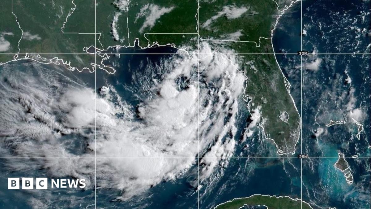
The heat is oppressive. It’s the kind of humid weight that sits on your chest before a storm ever touches down. And now, the sky is turning. Tropical Storm Bertha is here.
It’s not a hurricane yet. It’s small, slow, and currently drifting aimlessly near Florida. But the National Hurricane Center is sounding alarms. They aren’t talking about wind damage primarily. They are talking about water.
Bertha is located just 105 miles south of Panama City, Florida. Winds are clocking in at a modest 40 mph. But that changes fast.
The real danger isn’t the breeze. It’s the surge.
Forecasters are warning of “life-threatening storm surges” for the southeastern US coast. Specifically, the Gulf states are in the crosshairs. Alabama. Louisiana. Mississippi. Texas.
Where Is Tropical Storm Bertha Going?
The track is shifting northwest. Slowly. Moving at only 3 mph. But speed isn’t the issue. It’s persistence.
The NHC bulletin is blunt: Bertha will move near or along the northern Gull coast for the next several days. This isn’t a hit-and-run event. This is a siege.
The storm may strengthen over the weekend. Some models suggest it could make landfall in New Orleans by Wednesday. If it does, the consequences are severe.
Residents in Louisiana are already reacting. Sandbags are being distributed in New Orleans. People are clearing storm drains. They know what happens when water meets the city’s unique geography. The ground won’t absorb it all. The drains clog. The water rises.
What Rainfall and Surges Should You Expect?
The numbers are scary when you stop to think about them.
Some areas could see 8 inches of rain by Friday. That’s not a drizzle. That’s a deluge. Flash flooding is likely in urban areas where pavement prevents absorption.
The storm surge is equally dangerous. Officials predict surges of 1 to 4 feet along parts of the Louisiana and Mississippi coastline. One to four feet might not sound like much on a bathtub scale, but on a coastal shoreline, it’s enough to erase beaches, destroy structures, and kill.
A tropical storm watch is now in effect. It covers the area from the Ochlocknee River in Florida all the way west to the Jefferson/Plaquemines border in Louisiana. That is a long stretch of vulnerable coastline.
Is Bertha a Threat to Florida Specifically?
Yes, but the threat is evolving.
Initially, the focus was on the surge. Now, forecasters are watching for isolated tornadoes. These don’t need a massive system to spawn. They just need moisture and instability. Florida is on the hook for both rain and potential twisters.
The storm’s tropical-storm-force winds extend 70 miles out from the center. That means you don’t have to be in the eye to feel the impact. You can be miles away and still lose power. Still deal with flooding.
Will Bertha Become a Hurricane?
It might. The bulletin suggests Bertha may build in strength over the coming days. The waters in the Gulf are warm. Warm water fuels storms.
However, there’s a catch. By Thursday, the system is expected to weaken back into a tropical depression. And by the end of the week, it might dissipate entirely as it nears the Texas coast.
So, what does that mean for you? It means the peak danger is likely mid-week. Wednesday could be the worst day. After that, the system falls apart. But by then, the damage may be done.
This is only the second named storm this season. Last month, Tropical Storm Arthur brought flooding to the US. Bertha is testing us again. The infrastructure is already stressed. The